A few more facts about this area of Bolivia: As indicated earlier, the city of La Paz is located in a valley, but what I have found out that it varies over 600 meters in altitude within the valley: 3,600 M at its historical centre, down to 3,000 M at its lowest point. El Alto, the rim of the valley, is at an altitude of 4,100 meters. So within less than 1 mile, probably more like ½ a mile, there is a drop of over 1,100 meters. Un-flipping-believable.
 La Cumbre pass
This little excursion is a private one, so I have a driver (Pancho) and a guide (Eduardo) for the entire day. We took off in a little mini-bus just before 9 o’clock and Eduardo gave me a bit of a tour of parts of the city on our way up out of the valley, but this time in a north easterly direction. In total, including both La Paz and El Alto, there are over 3 million people living here. The total population of Bolivia, he said, was 9 million. (70% of whom are indigenous, 25% mestisos and 5% of European descent. $ 1 = approximately 8 Bolivianos.
The ladies wearing the traditional costumes are called either Cholas, or Cholitas. Cholas are married ladies and they are the ones who wear the bowler hats. Their skirts are made of horizontal pieces of material and they wear 4 layers of petticoats underneath. I’ve seen some who also wear pants under them; it is cold up here and if they are working in the fields, or walking into town, they need those layers for warmth. They will usually be wearing shawls as well and often use these to carry their babies, or to carry goods. Cholitas are unmarried women who are “parading” their wares. They do not wear the hats, their skirts are simple, and they only wear one layer of petticoat underneath. They also wear shawls. Most of these people live in the country, or are recent arrivals to the city. Their children quickly adopt regular dress; mostly tight jeans and clingy sweaters; they are teenagers after all. There does not appear to be much difference in the way the men dress: pants, shirt and sweater.
The children learn Spanish in school, however with the recent “new” Bolivian constitution, they also learn the idiom used within their local areas. The three main idioms are Quechuan, Aymara and Guarani (? not sure of spelling), or any of the other 33 idioms spoken by the locals in different areas of Bolivia. The government is now of the “extreme left” and has brought about many changes to the way the country is run. (Seems to be for the better, especially for the native people.)
One of my earlier guides indicated that people here did not finish the outside of their houses on purpose, so that they could pay fewer taxes. Eduardo does not agree; he strongly believes that most people build as funds become available (same as in Mexico). They buy the land, then either make the mud brick or buy the bricks, they build the first floor, then the second floor, and possibly a third one if required for one of the sons, and finally the last thing to do is to finish the outside of the home. There is probably a bit of truth in both stories. Eduardo also pointed out the mattresses that were for sale along the streets leading out of the city. I thought they were just big plastic bags containing ? ? ? whatever. They are actually filled with straw and are used in many of the homes where they cannot afford regular mattresses, or where regular ones would get mouldy very quickly. But they are really short mattresses. Bob L would definitely need two for his very tall person.
Another interesting point was that although we were seeing some waterfalls along the way, there are no springs in these mountains. All the water either comes from the glaciers on the high Andean mountains, from rain, or mist from the clouds. Eduardo believes that within 20 years there will be major problems in this area since the glaciers are melting and they do not get snow every year any more on those high mountain peaks. The tree line stops at about 3,300 meters of elevation. Higher than that, nothing much grows, similar to what I saw on the drive to Copacabana.
 Along the anti-plano
 Mountain bikers starting off their trek from the Alti-plano
 “El Camino de la muerte”
 Memorials along the road
 "Death Road Survivor" mountain biker group
This small dirt track was, for years, the only connecting road from La Paz across the mountains to the lower elevations of the eastern side of Bolivia. Our mini-van could barely make some of the curbs, and this road was used by big transport trucks, many of which ended up down the steep cliffs. There are crosses all along the road to attest to these deaths. The road is used now mainly by tourists like me, or by crazier people who mountain bike the 40+ km down the mountain to just below Coroico.
 "The" spot used for mountain bikers photo op. It gives you a good idea of the heights and danges of the route
 Passing one of the waterfalls, free car wash
We went from dry arid no grow zone, down to the tree line, to the mist forests, and down to the rain forests and beautiful agricultural areas.
So what’s in Coroico? Not much. It’s a small town built on a hillside (where else) with great views of the valleys below. In this case it wasn’t the destination that was important, but the road travelled and the vistas to get there. I saw some coca plantations and a few banana trees, mango trees, papaya trees, avocado trees (Yes ! they are trees here, not just bushes.) We were a bit early for lunch so Eduardo and Pancho discussed what they should show me, and off we went down yet another mountain side. If the first road is called “El Camino de la muerte” then this dirt track should definitely be called “suicide trek”. OH MY GOD ! Thankfully Pancho is an excellent driver, but there were times when I was really leaning over away from the precipice below when we turned some of those sharp corners. (Bruno: Shades of our day trip in the Lost Mountains of Arizona!) It took at least 45 minutes to drive all the way down to the river at the bottom of this valley.
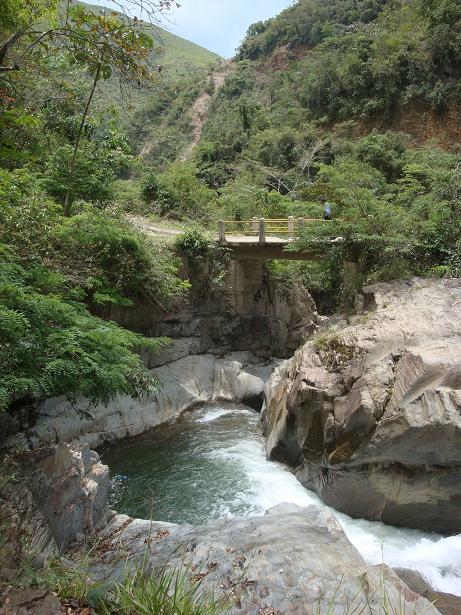 The river
 In the jungle growth
 Cuidado con este planta (Careful near this plant)
10 minute walk along the banks of the river (a raging stream really) and then back up the mountain we went. Roller coaster ride on a really bumpy road. Why do I put myself through this?
Got back up the mountain to Coroico and had a buffet lunch at the “Esmeralda Hotel” . Took a few pics and then the long drive back to La Paz, but this time using the “new” road. Fantastic, I thought….. until Eduardo mentioned that Pancho had to check on road conditions because part of the road had collapsed. ! ! ! WHAT ! ! !
 The "new" camino being reconstructed
 WHY would anyone build a highway along an unstable geological zone ?Yes, I swear this is true. I even took a picture of one of the signs that confirmed that we were in a “Geologically unstable zone”. How very reassuring. What happened to the “New” road? Turns out it’s just a “newer” road. In some high spots where the road overhangs the cliffs, there are huge cracks in the pavement where it is slowly breaking away.
 The "new" camino being reconstructed
 WHY would anyone build a highway along an unstable geological zone ?
There was a lot of re-construction work going on along the way and the roads were still quite treacherous. And just to aggravate the situation, the drivers are completely, off the wall, crazy! The worst I have seen in all my travels, whether they are on the highway or on city streets. I kid you not, they constantly play chicken with each other just to see who will back off first. It’s amazing that there aren’t more wrecked cars around. They will squeeze in between two cars where there is absolutely no WAY they can fit, until one of the other two cars backs off, or until they have to back off themselves. And the pollution from the cheap diesel means a lot of black smoke spewing out of their mufflers. Sorry, I’ve ended up venting about this stuff, but it just came to a head today after spending 11 hours on the road, and the third day in a row driving around in Bolivia.
It was still a great day and I really enjoyed the side trip. Pancho and Eduardo were just great.
Back to the hotel sometime after 6 pm. Dinner from 7 to 8, excellent as usual. The cuisine at Hotel Rosario is really outstanding.
Heard on the news that there had been a 6.9 earthquake in the Ica region of Peru, where I spent the night just a few weeks ago (after flying over the Nasca Lines). The cathedral in Ica was destroyed as well as 400 to 500 mud brick houses in the region. So far, only injuries reported; no deaths.

No comments:
Post a Comment